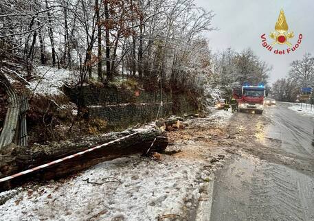
(ANSA) - ROME, DEC 9 - Italy will see more rain and snow this
week, starting Monday, weatherman Antonio Sanò said.
The start of the week will be characterized by persistent rain
and snow, even at low altitudes, in many regions, said Sanò,
founder of the website www.iLMeteo.it.
"The entry of cold currents into our seas will favor the
formation of a cyclone destined to cause heavy rain and
thunderstorms starting today and until Tuesday, especially in
the Center-South and on the two Major Islands", he said.
In the Apennines, intense snowfall is possible starting from
1200-1400 meters above sea level. The North will be affected
only marginally. "However - continues Sanò - the risk of
snowfall down to very low altitudes (300-500 meters) is not
excluded a priori, especially on the Dolomites, western Piedmont
and Emilia Romagna".
After a short break around mid-week, a new cyclonic vortex will
appear between Thursday 12th and Friday 13th, bringing a modest
worsening of the weather across much of central and southern
Italy.
This bad-weather front will have its greatest effects on
Saturday 14th.
Detailed forecast:
- Monday 9th. In the North: rain and snow on the hills of
Emilia Romagna and Piedmont. In the Center: unstable on the
Tyrrhenian coasts and in Sardinia. In the South: bad weather on
Tyrrhenian Calabria.
- Tuesday 10th. In the North: still a bit unstable in Emilia
Romagna and lower Piedmont. In the Center: scattered rain on
Umbria and Lazio, occasional on the Adriatic. In the South: rain
on Campania, Basilicata and Cosenza.
- Wednesday 11th. In the North: scattered clouds on the plains,
sunny on the Alps. In the Center: mostly dry. In the South: rain
on Campania. - Outlook: short anticyclonic break, then "modest"
bad weather. (ANSA).
Italy to see more rain and snow this week (4)
New cyclonic vortex to hit Thursday, weather to worsen Saturday
